
[Disaster Series] Floods and its Management in India
India is immensely vulnerable to floods. Flood is a disastrous occurrence causing a huge loss of lives and damage property, infrastructure and public utilities. It is a cause for concern that the flood-related damages are showing an increasing trend. Hence the study of flood management is an important aspect of disaster management.

What are the floods?
Inundation of land and human settlements by the rise of water in the channels and its spill-over presents the condition of flooding. They are caused by both natural and manmade causes.
What are the characteristics of floods?
- Slow in occurrence (except flash floods)
- Occur in well-defined regions
- Occur within expected time of the year
What are the types of the flood?
There are three main types of flood-
Surge (Coastal) Flood
- Floods occur in areas that lie on the coast of a sea, ocean, or a large open water body.
- It occurs due to extreme tidal conditions caused by severe weather.
- Very often it is produced by the hurricanes and other storm which pushes water onshore.
Fluvial (River) Flood
- It occurs when a river exceeds its capacity due to excessive rainfall over an extended period of time. Fluvial flooding is of following types
- Overbank flooding– this is the most common type of flooding where the water level rises and breaches the banks over time.
- Flash flooding– A flash flood is a sudden and rapid flooding of a low-lying area due to torrential rain coming with thunderstorm, hurricane, tropical storm etc.
Pluvial (Surface Flood)
- when heavy rainfall creates a flood event independent of an overflowing water body, it is called a surface or pluvial flood.
- It can happen in any urban area and even in the areas of higher elevation lying above coastal and river floodplains.
- When a torrential downpour makes the urban drainage system saturated and making the roads flooded, it is called urban flood.
What are the causes of flood?
Apart from natural causes, in the disaster of flood to occur, humans too lay a great role.
Following are the causes of flood-
Natural causes
- Heavy rainfall
- Heavy rainfall in the catchment area of a river causes water to overflow resulting in floods in nearby areas.
- The extremely dynamic monsoon regime which occurs in a short period of June to September creates heavy flooding in northern plains and north-eastern region.
- Snow melting in summer
- Himalayan rivers like Ganga cause flood in summer too due to the melting of snow.
- The floods of Brahmaputra river are due to both rainfall and snowmelt.
- Geography
- Low gradient of the Brahmaputra compounded with soft tertiary rocks make sedimentation faster that leads to choking of river channels.
- The heavy rainfall in hilly region causes floods in low lying nearby areas.
- Deposition of sediment
- River beds become shallow due to continuous sedimentation.
- The Himalayan rivers bring huge amount of sedimentation reducing water carrying capacity which results in overflow of water in huge amount.
- Change in course of the rivers
- Meandering nature of rivers in youthful stages cause in the change of course and brings floods.
- Earthquakes also result in fluvial regime change of a river and resulting in flooding. The Brahmaputra river is a prime example.
- Landslides
These are the major reasons in Himalayan region. The Uttarakhand floods of 2013 were caused by the landslides along with cloudburst.
- Tsunami and cyclones: Tsunami brings huge amounts of water to the coasts and flooding occurs.
Anthropogenic causes
- Deforestation
- Vegetation restricts the flow of water and helps in percolation.
- The deforestation makes land obstruction-free.
- The deforestation also accelerates soil erosion and silting of river beds reducing its carrying capacity faster.
- Trespassing and interference of Drainage system
- The ill-planned construction of railways, roads, bridges and canals without paying heed to the natural fluvial regime cause floods.
- The short-term ad hoc measures of flood protection by an extensive network of embankments have deleterious effects on the regime of the river.
- Encroachment of natural floodplains for agriculture, infrastructure development reduces the retention capacity of the rivers.
- Population pressure
- Population pressure, especially in urban areas, causes faulty land use patterns, surface sealing that increases runoff.
- The urban heat island effect is emerging as a major cause.
- The encroachment of water reservoirs like lakes in urban areas.
- Improper drainage and faulty waste management system that chokes existing drainage system
- International reasons
- Origin of major rivers is in Nepal, China, Bhutan which makes effective control and early warning difficult.
- The cooperation in hydrological data exchange often gets mixed up with geopolitics.
What are the effects of floods?
- Loss of life
- Floods cause huge losses of life.
- Kerala floods of 2018 caused the death of 445 people
- Uttarakhand floods of 2013 caused the death of more than 5000 (presumed)
- Agriculture
- Recurrent floods submerge fields of agriculture leading to loss of harvest.
- The flood may render soil infertile by affecting its ingredients.
- Infrastructure
- Floods cause immense damage to the infrastructure like railways, roads, bridges.
- Electricity generation and distribution infrastructure is damaged.
- Health issues
- Lack of cleanliness, death of livestock and polluted water creates many health issues.
- The floods bring an outbreak of a disease like malaria, diarrhea and other waterborne disease.
- In fact, more deaths are caused due to after flood outbreaks than actual floods some times.
- Economy
- Economy faces double impact of destruction of infrastructure and cost of rebuilding.
- The funds must be released for rescue, relief, and rehabilitation that may have been planned for developmental work
- Environment
- The floods occurring in forest areas damage the ecosystem.
- There is a loss of flora and fauna.
- The Floods in Kaziranga national park caused deaths of wildlife including threatened One-Horned Rhino.
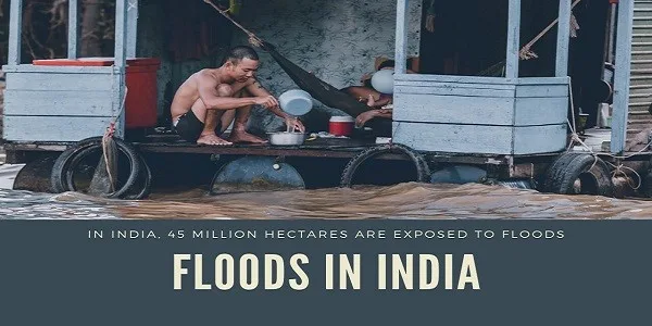
Floods in India
- The frequency of major floods is increasing as can be seen from year by year disastrous floods.
- The more interesting factor is that floods have occurred in areas that are not considered flood-prone.
- The National Flood Commission data state that Out of the total geographical area of 329 mha, more than 40 mha is flood-prone.
- The Ganga-Brahmaputra-Meghna basin accounts for 60% of the flood area.
The Flood-prone area in India
The flood-prone area can broadly be divided into the following four regions
- The Brahmaputra River Region
Assam, Arunachal Pradesh, Meghalaya, Mizoram, Manipur, Tripura, Nagaland, Sikkim and the northern parts of West Bengal
- The Ganga River Region
Uttarakhand, Uttar Pradesh, Jharkhand, Bihar, south and central parts of West Bengal, Punjab, parts of Haryana, Himachal Pradesh, Rajasthan, Madhya Pradesh and Delhi
- The North-west River Region
This region covers the states of Jammu and Kashmir, Punjab and parts of Himachal Pradesh, Haryana and Rajasthan
- The Central India and Deccan Region
This region covers the states of Andhra Pradesh, Karnataka, Tamil Nadu, Kerala, Orissa, Maharashtra, Gujarat, and parts of Madhya Pradesh
Flood Management in India
Almost every year, small and big floods affect some parts of the country or the other. Its management has been an important task for governments at the Union and States. The flood management, therefore, has been always a priority area for the successive governments
Government actions regarding flood management
- The National Flood Management Commission
- Launched in 1954
- Different structural and non-structural methods have been applied by various states under it.
- Rashtriya Barh Aayog, 1976
- To evolve a scientific, integrated and coordinated approach to flood control
- It recommended Flood plain zoning and management in order to regulate human activities.
- Regional task forces, 1996
It was set up to review the impact of recommendations of Rashtriya Barh Aayog.
It recommended large flood moderation projects, following up the enactment of flood plain zoning.
- National Water Policy, 2002
It recommended
• Basin-wise plan for flood control and management.
• Flood control to be given overriding consideration in reservoir regulation policy.
• More emphasis on non-structural measures.
• Strict regulation of settlements and economic activities in flood plains.
- K. Mittal Committee, 2003
Its main recommendations were
• Afforestation and treatment of catchment area, right land-use practices and others.
• In the river itself a construction of suitable hydraulic structures that may trap silt.
• Embankment along the aggrading river should be constructed, only after proper studies are made on its behaviour especially due to sedimentation load and resultant morphological changes.
Flood management in India follows the following stages
Flood management in India largely follows the NDMA guidelines of 2008 largely.
- Flood forecasting and warning
Flood forecasting (FF) enables us to be forewarned as to when the river is going to use its flood plain, to what extent and for how long.
It involves
- Data collection, transmission, processing and dissemination on hydrological parameters like rainfall.
- The Central Water Commission issues flood forecasting.
- Indian Meteorological department monitors and issues warning against extreme weather events.
- International cooperation with Nepal, Bhutan and China for hydrological data on river upper basins.
- The National Centre for Medium-Range Weather Forecasting (NCMRWF) provides medium-range weather helping in flood preparedness
- Flood prevention, mitigation, and preparedness
Structural measures
- Embankments/Banks, Flood Walls, Flood Levees
- Channel improvement
- Desilting and dredging of rivers
- Dams, reservoirs and water storage capacity improvement
- Drainage improvement by removing congestion
- Diversion of floodwater through programmes like river linking
- Catchment area treatment through afforestation
- Construction of sea walls.
Non-structural measures
- Flood plain zoning i.e. regulating of land use in the flood plain
- Floodproofing i.e. raising flood shelters, raising public utility installations above flood plain level.
- Integrated water resource management
Medical preparedness
- Patient evacuation plan
- Disaster management plan by health facilities
- Flood response
- The Disaster management act provided for an institutional mechanism for the response for flood situations
- The National Disaster Management Authority at the central level and State Disaster Management Authorities at the state level have the responsibility of laying down policies, plans and guidelines for disaster management and coordinating their enforcement and implementation for ensuring a timely and effective response to disasters.
- District Disaster Management Authority does the same at the district level
- National and State Disaster response force acts as the main response and rescue operation force
Flood response consists of
- Proper evacuation plan
- Deployment of search and rescue teams
- Emergency relief such as food, water, electricity, medical facilities.
- Formation of relief camps
- Coordination of relief contributions from people
- Capacity Building
The capacity building to combat flood situations forms the major part of flood management.
It consists of
- Education in school and colleges must incorporate disaster response and preparedness.
- Capacity building of the frontline force such as police, local NGOs, government officials to deal with the situation
- Research and development in flood management.
- Incorporation of the local traditional method of flood tackling.
- Capacity building of panchayat raj institutions to deal with the flood situation as they are the ground officials during flood.
- Once the flood situation goes away, proper documentation of the experience must be done to improve further.
What are the issues with the flood management in India?
- Delays in completion of projects under flood management program.
- The shortfall of resources, especially of central assistance to the states.
- Very few large dams in India have disaster management plans.
- Scientific assessment of flood zones is still incomplete.
- The state disaster management structure is not adopted by many states. The incomplete structure exacerbates the response issues.
- The flood forecasting is very poor. The weather forecasting lacks accuracy.
- Post-disaster deliberation is not done mostly which results in repeating of same mistakes every time
Way Forward
- The flood forecasting needs to be improved and most importantly decentralized by placing them in flood-prone areas.
- The flood mapping needs to be carried by flood management institutes periodically.
- Pre and post-monsoon inspection of structural measures will improve the preparedness.
- The capacity building of disaster response force must be carried with accommodating international best practices.
- Urban flooding is a major threat nowadays. The smart cities program needs to take into account this threat.
- The effects of climate change have been a major cause of recurrent flooding. The adoption and mitigation actions must be taken on a war footing.
- International cooperation in Hydrological data sharing must not be held hostage to geopolitical situations.
Practice Question for Mains
Discuss Floods as a major disaster threat. What are the institutional mechanisms in place to combat the menace (250 words)?
If you like this post, please share your feedback in the comments section below so that we will upload more posts like this.

Responses