
Soil Fertility Mapping in India

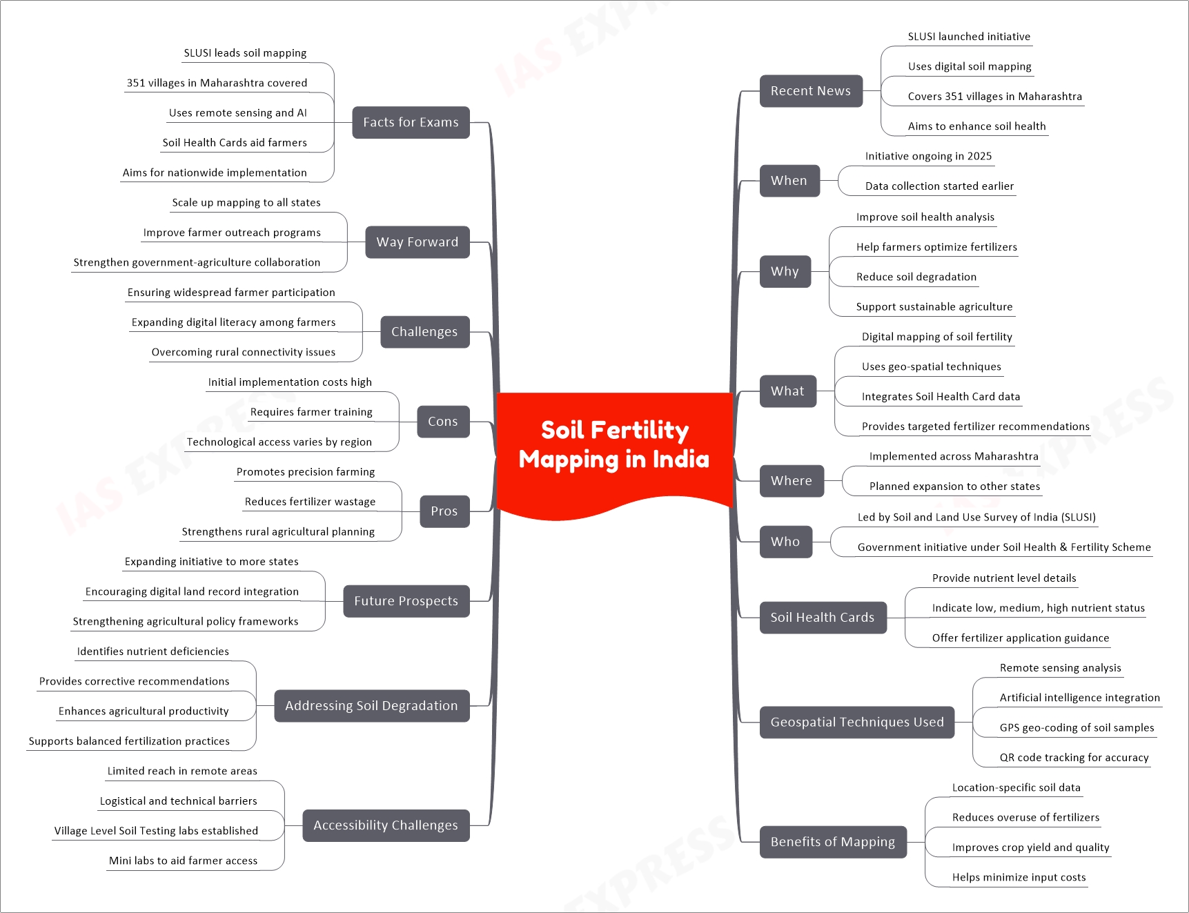
The Soil and Land Use Survey of India (SLUSI) is implementing a digital soil fertility mapping initiative using geo-spatial techniques and Soil Health Cards (SHC) to improve agricultural productivity. The project has mapped soil fertility in 351 villages across Maharashtra, helping farmers optimize fertilizer use. SHCs provide data on nutrient levels and offer customized recommendations. Geospatial tools like remote sensing and GPS ensure precise soil analysis. Challenges include accessibility in remote areas, but Village Level Soil Testing labs help mitigate this. The initiative supports sustainable farming, reduces soil degradation, and promotes balanced fertilizer application across India.
Related Posts


If you like this post, please share your feedback in the comments section below so that we will upload more posts like this.

Responses