
GPS Jamming & Spoofing: The Growing Threat Reshaping Global Flight Safety

From Current Affairs Notes for UPSC » Editorials & In-depths » This topic
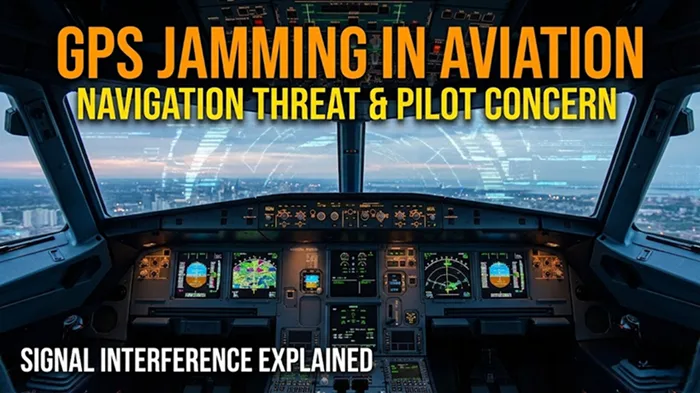
Incidents of GPS or GNSS interference, primarily jamming and spoofing of the signals, have seen a surge in recent years, raising concerns regarding safe and efficient flight operations globally. While rather common and even expected in airspace over and around active and latent conflict zones and tense international borders, such incidents are also increasingly being witnessed in other regions. Recent reports from late 2024 and 2025 indicate that major civil aviation hubs, far removed from traditional battlefields, are now grappling with this invisible danger. This widespread disruption challenges the foundational reliance of modern aviation on satellite navigation, compelling regulators and airlines to urgently reassess safety protocols and technological resilience in an increasingly volatile electronic warfare environment.
What are the fundamental types of interference?
Understanding GNSS and GPS
- Global Navigation Satellite Systems (GNSS) represent the overarching technology that includes constellations like America’s GPS, Europe’s Galileo, Russia’s GLONASS, and China’s BeiDou, which provide precise Positioning, Navigation, and Timing (PNT) data to aircraft.
- Modern aviation relies heavily on these systems not just for route navigation but also for critical functions like terrain awareness, time synchronization, and landing procedures.
Classification of Interference
- Jamming
- This is the brute-force method of interference where a device emits a powerful radio frequency signal that overpowers the relatively weak signal coming from satellites.
- The primary result of jamming is the loss of signal, causing the aircraft’s receivers to lose their “lock” on the satellites, effectively blinding the navigation system.
- It is often described as “denial of service” because the pilot simply loses access to GPS data, forcing a switch to backup systems.
- Spoofing
- This is a more sophisticated and dangerous technique where a malicious actor transmits counterfeit signals that mimic legitimate satellite frequencies.
- Unlike jamming, spoofing deceives the onboard computer into calculating a false position, potentially leading an aircraft off course without the pilot immediately realizing it.
- Advanced forms include meaconing, where genuine signals are intercepted and rebroadcast with a delay to confuse the receiver.
Why is this electronic threat emerging rapidly?
Geopolitical Instability
- The primary driver has been the proliferation of electronic warfare (EW) tactics in active conflict zones such as Eastern Europe and the Middle East, where combatants use jamming to thwart enemy drones and guided missiles.
- These powerful jamming signals often “spill over” into adjacent civil airspace, affecting commercial airliners that are merely passing through the region.
Technological Accessibility
- The barrier to entry for disrupting aviation has lowered significantly, with Commercial Off-The-Shelf (COTS) jamming devices becoming available on the grey market for relatively low prices.
- The rise of Software Defined Radios (SDR) has made it easier for non-state actors and even criminal elements to construct capable spoofing equipment with minimal technical expertise.
Dependence on Satellites
- The aviation sector’s transition from ground-based radar to satellite-based navigation (like ADS-B) for efficiency has inadvertently created a single point of failure that adversaries can exploit.
Where are these incidents primarily taking place?
Global Conflict Hotspots
- Historically, interference was confined to military operational areas, but recent data identifies the Baltic Sea, Black Sea, and Eastern Mediterranean as persistent high-risk zones.
- Pilots flying over the Middle East frequently report complete loss of GPS reliability, necessitating the use of older navigation methods.
Expansion to Non-Conflict Zones
- A worrying trend observed in 2024 and 2025 is the spread of these incidents to deep inland areas previously considered safe, affecting major commercial hubs.
- Civil aviation routes over countries like Finland, Poland, and recently parts of South Asia have experienced signal disruptions that cannot be solely attributed to spillover from war zones.
Historical Context
- While military jamming has existed for decades, the first significant large-scale impact on civil aviation emerged around 2010, primarily involving North Korea affecting flights in South Korea.
- The scale escalated dramatically after 2022, marking a shift from isolated incidents to a systemic global challenge.
Who are the primary actors and victims involved?
The Perpetrators
- State Actors remain the most capable sources, deploying high-power, truck-mounted electronic warfare units to protect sensitive assets or disrupt enemy operations.
- Non-State Actors, including insurgent groups and organized crime syndicates, increasingly utilize portable jammers to hide illicit activities like smuggling from surveillance.
- Privacy Seekers, such as truck drivers using “personal privacy devices” to block GPS tracking, inadvertently cause localized interference near airports.
The Victims
- Commercial Pilots bear the brunt of the workload, forcing them to manage constant cockpit alerts and revert to manual navigation tasks.
- Air Traffic Controllers (ATCs) face increased complexity in managing airspace when aircraft cannot report precise positions via satellite links.
- Passengers experience indirect impacts such as flight delays, longer flight paths to avoid jammed areas, and occasional diversions.
How do these interference mechanisms actually work?
Operational Mechanism
- A jammer floods the specific frequency band (like L1 or L5) with noise, rendering the satellite signal unintelligible to the aircraft’s antenna.
- In spoofing scenarios, the attacker aligns their fake signal with the satellite’s signal structure but gradually introduces a drift in time or position, pulling the aircraft’s navigation solution away from reality.
Impact on Aircraft Systems
- Navigation Display: The most immediate effect is the “loss of integrity” alert, where the map display may freeze or disappear.
- Terrain Warning Systems: The Ground Proximity Warning System (GPWS) may malfunction, either failing to warn of rising terrain or generating false “Pull Up” alarms because the plane “thinks” it is at ground level.
- Synthetic Vision: Modern cockpits with Synthetic Vision Systems (SVS) may display a completely wrong outside view, showing a runway where there is none.
- Time Synchronization: Onboard clocks and communication systems that rely on GPS for precise timing can desynchronize, affecting data link communications with the ground.
What are the recent developments in news?
Global Surge in 2025
- According to the International Air Transport Association (IATA), the frequency of GPS signal loss reports increased by over 200% between 2021 and 2024, a trend that has accelerated into 2025.
- European regulators like EASA have issued bulletins identifying specific corridors where GNSS reliability is effectively zero for prolonged periods.
Indian Aviation Incidents
- In late 2024 and early 2025, a wave of interference incidents was reported near Delhi’s Indira Gandhi International Airport (IGIA), specifically affecting aircraft approaching Runway 10.
- Pilots reported their navigation systems showing them miles off course while on final approach, a classic signature of spoofing rather than simple jamming.
- The Ministry of Civil Aviation confirmed in Parliament that besides Delhi, reports have come from airports in Mumbai, Bengaluru, Hyderabad, Chennai, Kolkata, and Amritsar.
How is the Indian aviation sector affected?
Specific Vulnerabilities
- The incident reports from Amritsar are historically linked to its proximity to the western border, where military-grade interference is common.
- However, the recent spread to metropolitan hubs like Hyderabad and Chennai suggests either the proliferation of unregulated privacy jammers or sophisticated testing by unknown entities.
Government Response
- The Directorate General of Civil Aviation (DGCA) issued an advisory circular in late 2023 and updated Standard Operating Procedures (SOPs) in November 2025 mandating immediate reporting of GNSS anomalies.
- The Wireless Monitoring Organisation (WMO) has been tasked with hunting down the sources of these rogue signals, using “direction-finding” teams to triangulate illegal jammers near airports.
- India maintains a robust Minimum Operating Network (MON) of ground-based aids like VOR (VHF Omnidirectional Range) and DME (Distance Measuring Equipment), which have proven crucial as reliable backups during these outages.
Comparison Chart: Jamming vs Spoofing
| Feature | Jamming | Spoofing |
| Primary Action | Blocking or overpowering the signal | Faking or mimicking the signal |
| Intent | Denial of service (make GPS unavailable) | Deception (provide false location/time) |
| Detection | Easier to detect (signal loss alarm) | Harder to detect (looks like real data) |
| Risk Level | Moderate (forces backup navigation) | High (can lead to unrecognized course deviation) |
| Equipment | Simple, cheap noise generators | Complex, sophisticated signal transmitters |
| Pilot Response | Switch to Inertial/Ground aids | Cross-check coordinates, visual confirmation |
What is the significance of this threat?
Erosion of Trust
- The repeated failure of satellite navigation undermines pilot confidence in automated systems, leading to a psychological state where crews may ignore valid warnings, assuming they are glitches.
- This “normalization of deviance” is a critical safety risk in aviation culture.
Economic Impact
- Airlines are forced to carry extra fuel for potential diversions or lower-altitude flying where ground sensors are more effective, increasing operational costs.
- Airports may have to reduce their movements per hour capacity if satellite-based precision approaches (like RNP AR) are unavailable, causing congestion.
What are the limitations and challenges faced?
Detection Difficulty
- Pinpointing the exact location of a mobile jammer in a dense urban environment like Delhi or Mumbai is technically challenging due to signal reflection off buildings.
- Many interference sources are intermittent, appearing for only a few minutes when a truck passes by, making them hard for enforcement agencies to catch in the act.
Obsolescence of Legacy Systems
- While ground-based aids like VOR are reliable, many countries have been dismantling them to save costs, assuming GPS would always be available.
- Rebuilding or maintaining this “legacy” infrastructure is expensive and viewed as a step backward in modernization.
Sovereignty Issues
- When interference originates across a hostile border (cross-border jamming), the affected country has limited diplomatic or technical means to stop the source directly.
What is the way forward for aviation?
Technological Resilience
- The industry is moving towards Multi-Constellation, Multi-Frequency (MCMF) receivers that can cross-reference signals from GPS, Galileo, and BeiDou simultaneously to filter out bad data.
- Implementation of Receiver Autonomous Integrity Monitoring (RAIM) software helps the onboard computer detect and exclude a “lying” satellite signal before it affects the flight path.
Alternative Navigation
- There is a renewed focus on Alternative Positioning, Navigation, and Timing (A-PNT) technologies that do not rely on satellites.
- Advanced Inertial Reference Systems (IRS), which use laser gyroscopes to track position without external signals, are being upgraded to provide accurate navigation for longer durations during GPS outages.
- Terrain contour matching and vision-based navigation are emerging as futuristic backups that use cameras to read the ground below.
Regulatory Enforcement
- Stricter laws against the possession and sale of “privacy jammers” are needed, with heavy penalties for usage near critical infrastructure.
- International cooperation through ICAO (International Civil Aviation Organization) is essential to establish protocols for sharing interference data in real-time.
Conclusion
The surge in GPS jamming and spoofing represents a paradigm shift in aviation safety, moving the sector from an era of unquestioned reliance on satellite precision to one of necessary vigilance and redundancy. While the skies remain safe due to the high training standards of pilots and the robustness of backup ground-based systems, the threat is no longer confined to war zones. As incidents in Indian skies have shown, the invisible battle for the spectrum is now a global reality. Ensuring the future of safe flight will require a balanced approach that embraces advanced satellite technology while maintaining the “old-school” skills and infrastructure that provide the ultimate safety net against electronic deception.
Q. Discuss the vulnerability of modern civil aviation to Electronic Warfare (EW) spillover, specifically GNSS spoofing. How does the persistence of ‘legacy’ ground-based infrastructure in India act as a strategic resilience factor? (250 words)

Related Posts

If you like this post, please share your feedback in the comments section below so that we will upload more posts like this.

Responses