
Aerial Seismic Survey


News:
What:
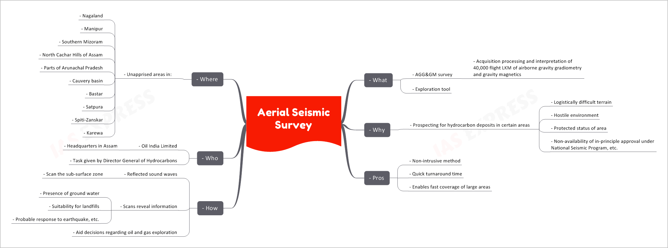
- Aerial seismic survey is also known as an AGG&GM survey i.e. ““acquisition processing and interpretation of 40,000 flight LKM of airborne gravity gradiometry and gravity magnetics”.
- It is an exploration tool.
Why:
- In certain areas, prospecting for hydrocarbon deposits is constrained due to several reasons:
- Logistically difficult t
Related Posts



If you like this post, please share your feedback in the comments section below so that we will upload more posts like this.

Responses